

Store GIS Map Layer Metadata
One of the popular features in Citizen Services is the support for ESRI ArcGIS maps. We let customers use their ArcGIS implementations to validate addresses prior to request submission, and for displaying the maps themselves throughout the solution. In this release we’ve expanded the GIS support to include the ability to capture map layer metadata.
In ESRI ArcGIS Customers may add “layers” to their maps that overlay information such as school districts, police precincts, among other things. In this release of Citizen Services, we allow customers to store up to four layer values along with the service request types.
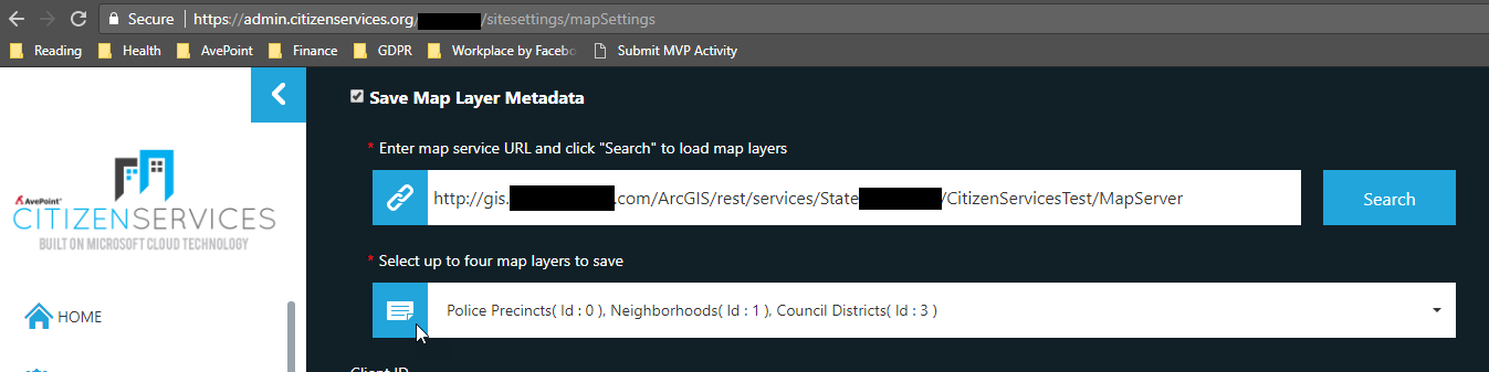
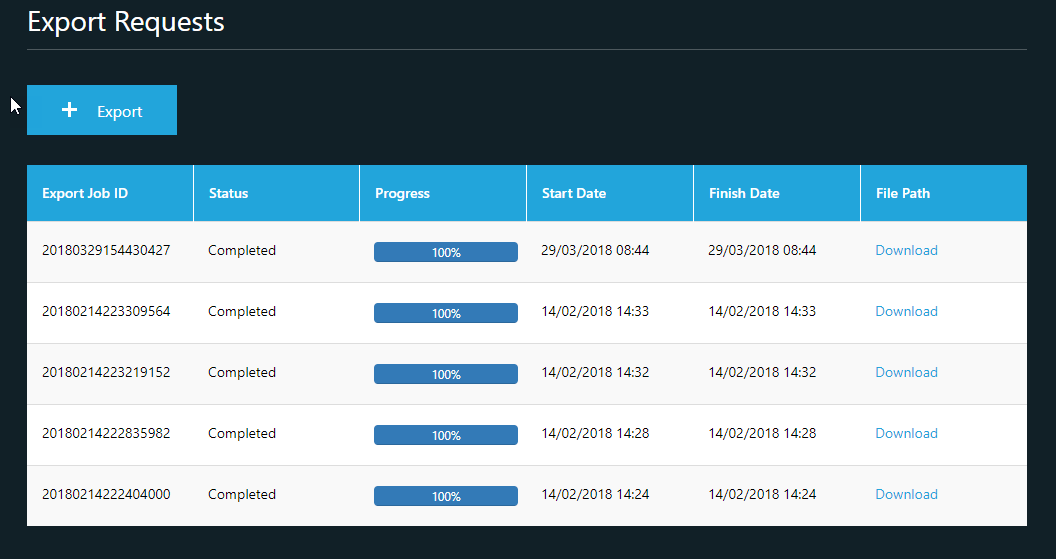
Capturing this metadata from the service requests allows customers to perform more detailed reporting about their requests by, for example, filtering their service requests by neighborhood or council district. This metadata can be viewed by exporting the service request data using the “Export Requests” feature of the Internal Portal.
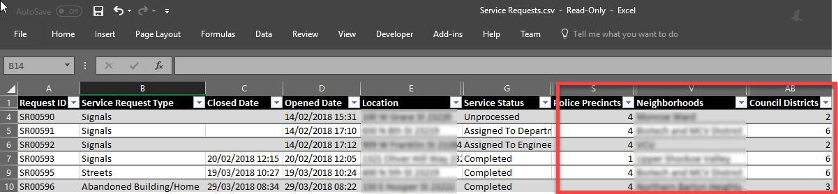
Using this, customers can perform any ad-hoc reporting and analysis they want and include this map layer data.
Clickable Banners
The hero images on the home page of the Citizen Portal are a great way to share news, show off the beauty of your municipality and shine light on stories from your community. We’ve now added the ability to add hyperlinks to the banners so that viewers can click on them to learn more about the topic.
As always, check back on this site soon as we’ll be posting more feature updates in the coming months!